

A Buyer's Guide to the Wild and Scenic Loxahatchee River


The Loxahatchee River runs through nearly every serious conversation about waterfront living in Jupiter and Tequesta. Its central embayment feeds the Jupiter Inlet, its residential forks hold some of the area's most established boating neighborhoods, and its upper reaches remain wild enough that in 1985 the federal government designated a portion of the river as Florida's first national Wild and Scenic River.
For buyers, that combination is unusual. Few places on the southeast coast of Florida let you keep a boat behind the house, reach the Atlantic in minutes, and paddle a canoe beneath centuries-old cypress trees on the same body of water. Understanding how the river is laid out, which parts are protected, and which parts are navigable is one of the most useful pieces of homework a waterfront buyer in this market can do.
Florida's First Wild and Scenic River
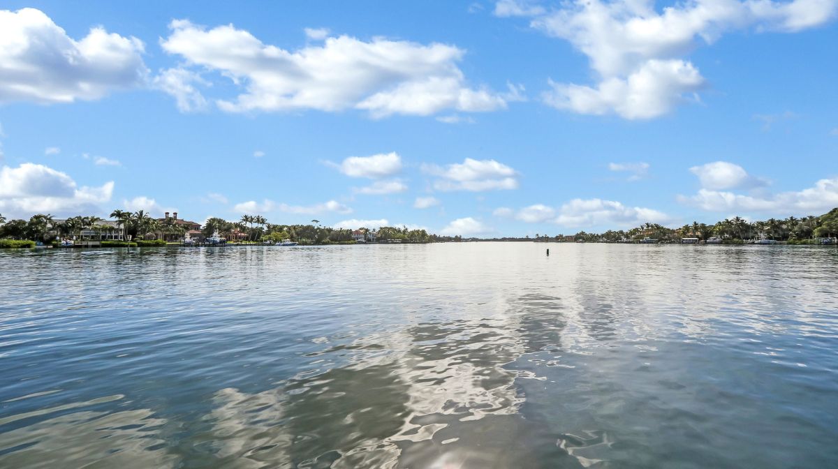
On May 17, 1985, a stretch of the Northwest Fork of the Loxahatchee became the first river segment in Florida admitted to the National Wild and Scenic Rivers System. The designated corridor runs from Riverbend Park in Jupiter downstream through Jonathan Dickinson State Park in southern Martin County. Only one other Florida river, the Wekiva near Orlando, has earned the same status, and that came fifteen years later.
The Loxahatchee is often described in state documents as the last free-flowing river in southeast Florida, and its name comes from a Seminole phrase generally translated as river of turtles. Both details tend to resonate with buyers who came to this area precisely because it still feels connected to an older Florida. The upper river looks much the way it did generations ago: a narrow, tannin-stained channel winding under a closed canopy of cypress, with alligators, turtles, manatees, and wading birds along the banks.
One River, Three Forks
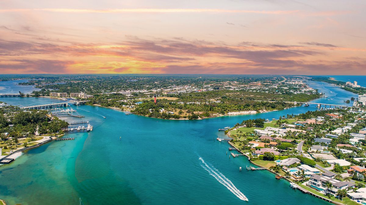
The river system has three main forks that meet in a central embayment before flowing out to the Atlantic through the Jupiter Inlet. Each fork plays a different role in the local market, and buyers benefit from keeping them straight.
The North Fork is where much of the residential story happens. It winds along the western edge of Tequesta, lined with mangroves and established neighborhoods, and connects south toward the embayment and the Intracoastal Waterway.
The Northwest Fork carries the federal designation, but only in its upper reaches, where it flows through Riverbend Park and Jonathan Dickinson State Park. Below the fixed bridge at SE Island Way, the character changes completely. The lower Northwest Fork is heavily developed, lined with waterfront homes every bit as established as those on the North Fork, and it functions as boating water rather than paddle water.
The Southwest Fork reaches into Jupiter and connects the river system to the drainage network that was engineered across this part of the county in the mid-twentieth century. The central embayment, where the forks converge near the Jupiter Lighthouse, is brackish water shaped by the tides moving through the inlet.
What the Designation Actually Protects
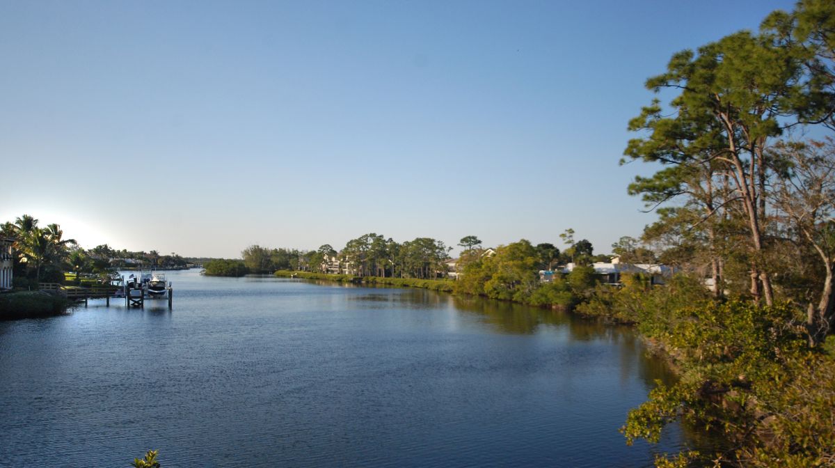
A Wild and Scenic designation is more than an honorific. It came with a federally recognized management plan, and the corridor is reinforced by overlapping protections that predate and follow it. The Loxahatchee River-Lake Worth Creek Aquatic Preserve was established in 1970, portions of the river carry Outstanding Florida Waters status, and thousands of acres of surrounding land sit inside Jonathan Dickinson State Park and Riverbend Park.
For a buyer, the practical takeaway is permanence. The wild stretch of the Loxahatchee is publicly owned or protected to a degree that is rare on this coast, which means the natural character that draws people to Jupiter and Tequesta is not waiting on the next zoning decision. The river has also been the focus of decades of restoration work, because the permanent opening of the Jupiter Inlet in 1947 and the canal construction that followed pushed saltwater farther upstream than the historic river ever experienced. Public agencies have spent years managing freshwater flows to protect the cypress floodplain that makes the upper river what it is.
Where People Actually Live on the River
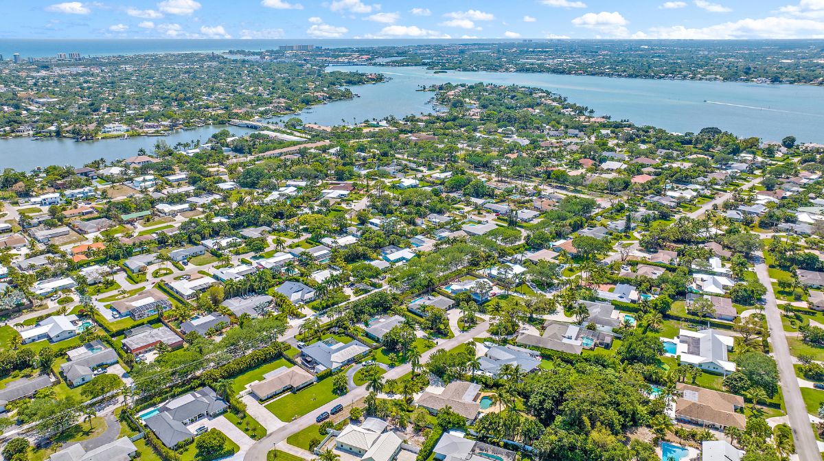
Residential waterfront on the Loxahatchee stretches across the North Fork, the lower Northwest Fork, and the central embayment. On the Tequesta side, Tequesta Country Club is the anchor, a community of roughly 550 custom homes bordered by the North Fork to the east, the central embayment to the south, and the Northwest Fork to the west, with riverfront parks, a community boat ramp and day dock, and optional club membership. Country Club Point and North River Plantation offer canal and riverfront homes with private docks, and River Ridge adds gated riverfront living along the mangrove-lined North Fork.
On the Jupiter side, Pennock Point is one of the area's signature riverfront addresses, a peninsula of larger estate lots in unincorporated Palm Beach County, and the Loxahatchee River Road corridor offers riverfront and river-access homes with a quieter, older Jupiter character.
Boating Realities on the Loxahatchee
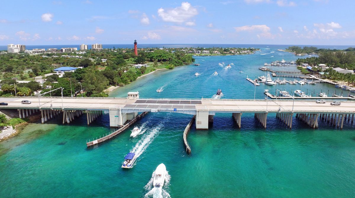
The river rewards buyers who know its bridges. From the central embayment, the run to the Jupiter Inlet passes beneath two of them: the State Road 811 or Alternate A1A bridge, which is fixed but offers a clearance of about 20 feet, and the US 1 bridge, which opens for marine traffic. On the North Fork, the Tequesta Drive bridge is fixed, so buyers on the upper North Fork need to measure their vessel against it, while the County Line Road bridge farther north sits beyond the last of the residential waterfront. On the Northwest Fork, the fixed bridge at SE Island Way marks the practical upstream limit for larger boats. The Southwest Fork is the most restricted of the three, with three fixed bridges beginning at Loxahatchee River Road near its mouth, which generally limits that fork to smaller craft. None of this shows up reliably in listing photos, so buyers running larger boats should confirm the full route from a specific dock to the inlet before getting attached to a property.
Above the SE Island Way Bridge, the Northwest Fork transitions quickly from boat water to paddle water. The designated corridor is narrow, shallow in places, and interrupted by two historic log dams, Lainhart and Masten, that canoes and kayaks portage around. Trapper Nelson's homestead, roughly midway down the wild stretch, can be reached only by water, whether by kayak, small boat, or the park's guided pontoon tours. In other words, the wild river is a place you visit from your waterfront home, and that separation is exactly what has kept it wild.
The Wild Stretch as a Backyard Amenity
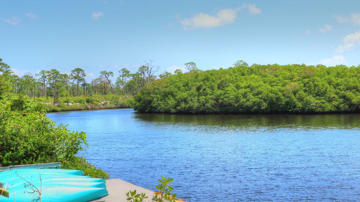
Owning near the Loxahatchee means the state's most celebrated paddling trail starts a few minutes from your driveway. Canoe and kayak rentals are available at Riverbend Park at the top of the run and at Jonathan Dickinson State Park at the bottom, and the full trip between them covers about eight and a half miles of river. Along the way sits the preserved 1930s camp of Trapper Nelson, the so-called Wildman of the Loxahatchee, whose homestead and one-time jungle zoo remain one of the region's most distinctive historic sites. Jonathan Dickinson State Park adds miles of hiking, biking, and equestrian trails, along with some of the best birding in south Florida.
For many buyers, this is the quiet argument for the area. Plenty of Florida communities offer docks and inlet access. Very few pair them with a federally protected river that still looks the way it did before the coast was developed.
The Bottom Line
The Loxahatchee River gives the Jupiter and Tequesta market a dimension that most waterfront markets never have. One river connects protected wilderness, established residential neighborhoods, and one of the most reliable inlets on Florida's east coast. Which part of the river fits you depends on how you plan to use the water, and that is a question best answered street by street and dock by dock.
Waterfront Properties has spent decades working the neighborhoods along the Loxahatchee, from the North Fork canals of Tequesta to the estate lots of Pennock Point. If the river is calling, contact us to start your search here.
Frequently Asked Questions
Is the Loxahatchee River a Wild and Scenic River?
Yes. On May 17, 1985, a stretch of the Northwest Fork of the Loxahatchee became the first river segment in Florida admitted to the National Wild and Scenic Rivers System. Only one other Florida river, the Wekiva near Orlando, has earned the same status, and that came fifteen years later.
What part of the Loxahatchee River is designated Wild and Scenic?
The designation applies to the upper reaches of the Northwest Fork. The designated corridor runs from Riverbend Park in Jupiter downstream through Jonathan Dickinson State Park in southern Martin County. Below the fixed bridge at SE Island Way, the lower Northwest Fork is heavily developed and functions as boating water rather than paddle water.
What does the name Loxahatchee mean?
The name comes from a Seminole phrase generally translated as river of turtles. The Loxahatchee is also often described in state documents as the last free-flowing river in southeast Florida.
Are there fixed bridges on the Loxahatchee River?
Yes, and they vary by fork. On the North Fork, the Tequesta Drive bridge is fixed, and the County Line Road bridge farther north sits beyond the last of the residential waterfront. On the Northwest Fork, the fixed bridge at SE Island Way marks the practical upstream limit for larger boats. The Southwest Fork is the most restricted, with three fixed bridges beginning at Loxahatchee River Road near its mouth, which generally limits that fork to smaller craft. Over the central embayment, the State Road 811 or Alternate A1A bridge is fixed with a clearance of about 20 feet, while the US 1 bridge opens for marine traffic.
Can you boat from the Loxahatchee River to the Atlantic Ocean?
Yes. The river's three forks meet in a central embayment that flows out to the Atlantic through the Jupiter Inlet. From the embayment, the run to the inlet passes beneath the State Road 811 or Alternate A1A bridge, which is fixed but offers a clearance of about 20 feet, and the US 1 bridge, which opens for marine traffic.
Which neighborhoods sit on the Loxahatchee River?
On the Tequesta side, Tequesta Country Club is the anchor, a community of roughly 550 custom homes bordered by the North Fork to the east, the central embayment to the south, and the Northwest Fork to the west. Country Club Point and North River Plantation offer canal and riverfront homes with private docks, and River Ridge adds gated riverfront living along the North Fork. On the Jupiter side, Pennock Point is a peninsula of larger estate lots in unincorporated Palm Beach County, and the Loxahatchee River Road corridor offers riverfront and river-access homes.
Can you kayak or canoe the Loxahatchee River?
Yes. Canoe and kayak rentals are available at Riverbend Park at the top of the run and at Jonathan Dickinson State Park at the bottom, and the full trip between them covers about eight and a half miles of river. The designated corridor is narrow, shallow in places, and interrupted by two historic log dams, Lainhart and Masten, that paddlers portage around.
What is Trapper Nelson's camp on the Loxahatchee River?
It is the preserved 1930s camp of Trapper Nelson, the so-called Wildman of the Loxahatchee, whose homestead and one-time jungle zoo remain one of the region's most distinctive historic sites. The site sits roughly midway down the wild stretch and can be reached only by water, whether by kayak, small boat, or the park's guided pontoon tours.
What protections apply to the Loxahatchee River besides the Wild and Scenic designation?
The designation came with a federally recognized management plan, and the corridor is reinforced by overlapping protections. The Loxahatchee River-Lake Worth Creek Aquatic Preserve was established in 1970, portions of the river carry Outstanding Florida Waters status, and thousands of acres of surrounding land sit inside Jonathan Dickinson State Park and Riverbend Par
Leave A Comment